- Close(x)
- Home
- About Tsenden
- Destinations
- TOUR & TREK PACKAGES
- Accommodations
- News & Events
- FAQs
- Destinations
- Tour & Travel Packages
- Festivals
- Latest Blogs
- Places of Interest
- Contact Us
- Book Now

The Soi Yaksa Trek, also known as the Jomolhari Loop, is a premier high-altitude journey that offers some of the most spectacular, close-up views of Mount Jomolhari and Jichu Drake. This itinerary balances physical challenge with cultural exploration, beginning with a pilgrimage hike to the iconic Tiger’s Nest Monastery before venturing into the rugged wilderness. It is an ideal alternative for trekkers who want to experience the grandeur of the Himalayas and remote yak herder settlements without the longer commitment of the full Lingzhi circuit.
NA
NA
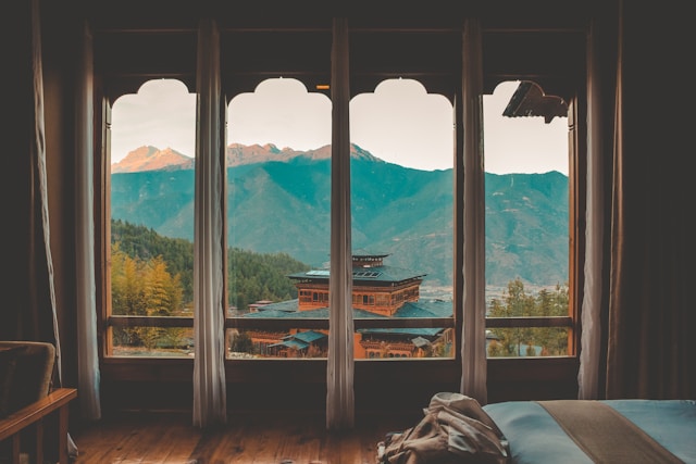
Paro, Thimphu, Punakha
Jomolhari Base Camp: Spend time at Jangothang, one of the world’s most beautiful base camps, situated at the foot of the "Bride of the Himalayas" (7,326m).
Tiger’s Nest Pilgrimage: Kick off the adventure with a hike to Taktsang Monastery, Bhutan's most famous landmark perched on a sheer cliffside.
High Mountain Passes: Conquer the Bonte La (4,890m) and Takhung La (4,520m), offering panoramic vistas of Basingthang and Chatarake peaks.
Alpine Lakes & Wildlife: Visit the turquoise waters of Tshophu Lake, known for inhabiting rare ruddy shelducks and surrounding yak grazing pastures.
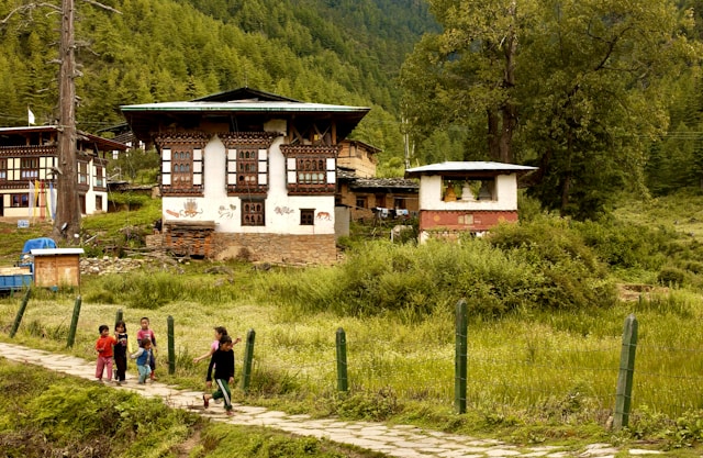
Remote Highland Culture: Traverse "hidden" valleys and stay near traditional yak herder huts, gaining a rare glimpse into the resilient lifestyle of Bhutanese highlanders.
(17KM | 5-6 HOURS | 230M ASCENT | DESCENT 60M | CAMP ALT 2870M)
Drive about 12 km north of Paro valley from your hotel to the historic Drugyal Dzong
ruins at 2,580m. From there your trek starts. You will pass through Mitshi Zampa and
Sangatan, and also the Gunitsawa army post.
You will halt at Sharna Zampa.
13KM | 4-5 HOURS | 200M ASCENT | 1650M DESCENT | CAMP ALT 2730M
You will have to climb up the Thombu La at 4380m today. The trail then drops gradually
to about 4000m, backing down the ridge, and you finally reach the helipad at Gunitsawa
(2730m).
(22KM | 7-8 HOURS | 690M ASCENT | CAMP ALT 3750M)
Resume the trekking. After 2 hours of continuous hiking and crossing several streams,
you will reach Shingkharap, a stone house at 3110m. There, we will have lunch and
continue trekking. After climbing up through rhododendron forests and finally crossing
the bridge again, we reach our camp at 3750m, which is amidst beautiful meadows.
(19KM | 5-6 HOURS | 290M ASCENT | CAMP ALT 4040M)
Today is not a long trekking day but a significant height gain as your trail goes above the
tree line. After hours of trekking, we will break for the day in Jangothang at an altitude
of 4,040m. From here, the views of Mount Jumolhari and Jichu Drake are superb.
Today, you will spend a day doing a four-hour acclimatization hike to the north of your
camp. There is practically no trail but you will climb on an open and endless slope till
you see the view of Mt Jichu Drakye (6989m). You can scramble further up to 4895m
(higher than Mount Blanc) to see an amazing view of Mount Jumolhari.
(16KM | 6-7 HOURS | 850M ASCENT | 1090DESCENT | CAMP ALT 3800M)
Today, you will trek through the torques of Tshophu lake (4380 meters), which is
inhabited by ruddy shelducks. Then descend into a hidden valley and climb steeply to
Bonte La at 4890m, the highest point of the trek with great mountain views of
Basingthang (5500m) and Chatarake (5570m). After the pass, the trail descends
crisscrossing yak trails down to the Dhumzo Chhu and after walking downstream past a
few houses you arrive at a camp at 3800 meters.
(11KM | 4-5 HOURS | 720M ASCENT | 340M DESCENT | CAMP ALT 4180M)
As usual, your trek will continue to descend and ascend. You will pass Takhung La
(4520 m). A short descent leads to wide and grassy Thombu Shong (4180m) with few
yak herder’s huts.
13KM | 4-5 HOURS | 200M ASCENT | 1650M DESCENT | CAMP ALT 2730M
You will have to climb up the Thombu La at 4380m today. The trail then drops gradually
to about 4000m, backing down the ridge, and you finally reach the helipad at Gunitsawa
(2730m).
17KM | 5-6 HOURS | 150M DESCENT
After breakfast, we retrace back through blue pine forests downstream Paro Chhu River,
farmhouses, rice fields, and small human settlements to Drugyal Dzong. Your car will be
waiting here to transfer you to the hotel. Overnight at Hotel in Paro.
+975 12345 69874
Make Enquiry